Wednesday, May 6, 2009
Third Beach an Impressive Sight
Olympic National Parks 48 miles of wilderness coastline includes many secluded beaches, but a few of them are have relatively close access from roads. Third Beach is 1.6 miles from La Push Road west of Forks. The trail had surprisingly large trees, both hemlock and sitka spruce.
I can be reached via a super freeway of a trail from beginning to end. The final quarter mile drops about 200 feet down a drainage which empties on the beach. It is also a good source of water for the longer 17 mile hike down the south coast wilderness to Oil City and the Hoh River drainage.
Looking south on Third Beach show an impassable headland that an overland trail must solve.
My recent hike to Third Beach found a pair backpackers camped behind a rock on the small beach. That evening found a mild high tide and a rough surf which amounted to limited space on the beach. Waves lapped the 36 inch plateau where their tent was located and wetted my boots as I looked for the southern exit from the beach.
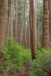
Large Sitka Spruce and Hemlock trees highlight the trail to Third Beach.A thin waterfall drops from the headland to the crashing surf below on the south side of Third Beach.
A trail departs from the over the headland to the next beach to the south. Using the beach as an overnight camp is permitted, but permits are necessary through the Olympic National Park Wilderness Information Center or the various locations throughout the park.
Labels:
La Push,
Olympic National Park,
Third Beach
Quinault is the Closest of the Olympic Rain Forests
It was the first weekend of December 2007 that I had planned to visit Lake Quinault. The lake lies at low elevation which allows winter explorations in its rain-forests and along its shores.
Lake Quinault is located on the southwest side of the Olympic Peninsula.
Of course the 1st weekend of December 2007 strikes an ominous slot in our collective memories in Western Washington. At Quinault, not only did 20 inches of rain fall, but the winds that accompanied that storm knocked down entire tracts of mature timber. One only has to look across the South Shore Road at the U.S. Forest Service Information outlet for a glimpse. Huge old growth trees litters the ground to depths of eight to 15 feet.
A year and a half later, I wandered the trails of the Lake Quinault south shore. Several loops allow a total of about 16 miles of unfettered hiking opportunities. Most trails wander a hillside of old growth rain forest, but there was trail access to the lake shore between the USFS Compound and a pair of campgrounds. The trails all connect and there are multiple trailheads from which to begin.
A huge Sitka Spruce tree is located on the southeast side of the lake.
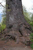
Just to the east of the USFS facilities, there is a small parking area near a bridge over Evans Creek where there is trail access. On the southeast side of the lake, visitors can visit what is billed as the world's largest Sitka Spruce (after some research it is actually the third largest) using a 0.3 mile trail. Regardless of the arguments, the tree is impressive.
With no tri-pod, I can only offer this poorly composed photo for a size relationship to the massive Sitka Spruce.
Lake Quinault is 36 miles north of Hoquiam just on the fringe of my "local" recreation limits and is a part of the greater Olympic National Park complex. The U.S. Forest Service manages the southern shore of the lake. Some trailheads, including the Quinault Rain Forest Trail require a federal recreation pass.
This 450 year old Douglas Fir is located along the Quinault Rain Forest Trail.
Lake Quinault is a portal to a much larger and primeval wilderness in Olympic National Park. If you are not that adventurous, the south shore has more than enough to pique your interest.
A scene from the Quinault Rain Forest Trail.
Subscribe to:
Posts (Atom)