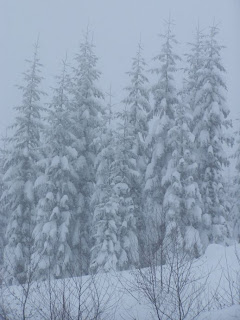
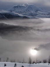
Anyone that stepped out their door or looked out their window this week, had to stop, take a breath and perhaps reminisce a little. For those with less than twenty or thirty winters’ experience, this last week’s extended winter weather will be etched in their memories for quite some time.
Downtown Winlock wears a significant mantle of snow on December 22nd, 2008.
Some however look at this week as a mere dusting compared to winters of the past. Some younger readers may remember the winter of 2003-2004 when a week of heavy weather struck the week after New Years. Most areas saw about 10 inches of snow followed by ice storms that knocked out power to 150,000 people in Southwest Washington.
Able-bodied men shovel snow off of buildings in Downtown Winlock.
The winter of 1968-69 was the last of the “deep freeze” events. For 18 days, Southwest Washington had temperatures that were below freezing including Portland’s all-time low of three degrees below zero and an equal number of days with snow on the ground. Oregon’s Rose City measured 8 to 14 inches on the ground most of that time period with a total of 18.9 inches of snowfall. Seattle reported 67 inches of snowfall. In my childhood days, I remember the snow depth in Eugene over my head.
A winter scene on Olaqua Creek.
Paul Foster of Winlock returned from a California logging operation to his King Road farm in the fall of 1968 and it soon began to snow. “We were never totally without snow on the ground until March,” he said. “We had 30 inches on the level,“ he explained. "That much snow was taking down old barns and chicken houses at that time,” Foster continued. “Every able-bodied person helped shovel off roofs”. Foster also explained how he would use his D-4 CAT and a piece of plywood to accelerate the snow removal process .
Blue skies unfold a beautiful scene in December of 2008 in Western Washington.
Locally, many folks responded with interest to stories of the winter of 1949-50. Statistically, it really started in earnest on January 13th. “The winds were coming out of the east and my dad said we were in for it,” said life-long Winlock resident Mike Porter who was 7 at the time. The temperature stayed below freezing and the snow started to pile up at their place on Hawkins Road. “We couldn’t get the old 39 Ford out of its parking place so we took a horse with a trailer to town,” he continued. “It was a wonderful time in life. We sat around the pot-bellied stove in the train station while the others shopped for supplies in Winlock. On the way home, we made deliveries to those that needed supplies”.
Left-Adam Russell and Josh Lowman of Longview snowboard down Washington Street. Adam Russell of Winlock executes a jump with his snowboard on the Washington Street snow run in Winlock.
Foster recalled how a group of kids slid down the Washington Street “snowplay” area in Winlock and ended up in the garage of the Catholic Church two blocks from the base of the hill.
Amber Paschich of Onalaska and Lydia Dolph slide down the Washington Street "Snowplay" area in Winlock in a rather unsuccessful manner.
That winter supplied Portland 41 inches of snowfall, while Vancouver accumulated 35.3 inches. Seattle garnered a one day total of 21.4 inches of snowfall and a monthly total of 63.6 inches. In addition, winds blew so hard that snow drifts of five to six feet blossomed on the landscape creating the ingredients of the region’s only true blizzard that caused 13 deaths. Many low elevation locations reported snow depths that exceeded 50 inches.
The sign still says "open" at Special Moments" in Downtown Winlock, despite icicles, snow and very little parking on a snow covered street in Downtown Winlock.
35 years earlier, the winter of 1915-16 supplied Seattle with its largest one day total snowfall as 21.5 inches of snow fell on February 2nd, 1916 collapsing roof of the St. James Cathedral. In January and February of that year, a grand total of 58 inches of snow fell in Seattle and reports of 2 to 4 feet of snow depth in Western Washington was not uncommon. Portland counted 27.9 inches.
Two deer lay in the snow on a side stree off Shannon Lewis Way in Winlock, Washington.
The 1880s were the good ol’ days of winter as Portland picked up 34.1 inches of snow during December of 1884. Seattle reported 47” of snow on the ground in January of 1880 and Bellingham reported “three weeks of snow” in January of 1871. Leaking into the next decade, Portland had its largest monthly snowfall total of 35.3 inches in January of 1890.
One of the 600 pound chickens scattered around Winlock was wearing a mantle of snow.
While many are debating this “La Nina” year and the prospects of a long drawn-out winter, one thing is for sure. History tells us about the potential of more winter to come as we enter the cold months of 2009.
Saturday, December 27, 2008
Wednesday, December 24, 2008
Winlock Basketball Tours the Redwoods
Last week, I had the honor to accompany the Winlock Basketball team on a trip to Northern California. I submitted this to my editor with a number of photos that took the experience away from sports amd more towards the team experience. My editor didn't place any of these photos with this article in the Town Crier. Let me know if these were important photos to accompany this story.
_________________________________________________
It is all about basketball and really it’s not. The Winlock boy’s basketball team traveled to Northern California where they played four games over four nights. 15 boys made up a small Varsity and Junior Varsity contingent that traveled to Fortuna, California for a game against Winlock Head Coach Gary Viggers’s alma mater Fortuna High School. Next, they stayed in Crescent City where they were a part of the 9th Annual Rotary Warrior Classic which hosted teams from all over the region.
One of the challenges this year is to find solid competition for an extraordinarily talented group of basketball players. During the summer, the group traveled as far as Reno to play teams that would prepare them for this season’s WIAA play.
With just 257 students in Grades 9-12, Gold Beach (Oregon)couldn't match athletes with this Winlock Basketball team. The Cardinals polished off the Panthers 75-33.
Winlock Schools Superintendent Richard Conley agrees with the difficulty in scheduling stronger competition closer to home. “A bigger school does not want to come and play a smaller school” he explained. “It puts them into a nearly no-win situation”.
Three teams came from schools with enrollments of 1,000 students or more on the trip. Fortuna presented the Cardinals with its first loss of the season with a miracle shot with 2.2 seconds left in the game. The boys took care of business against Central Valley from near Redding, California with a 64-48 victory that set up a much anticipated match-up with the home-standing Del Norte High School of Crescent City with 1,100 students in which the Cardinals won 52-40.
Winlock's Mike Kent gets an opportunity for a lay-up under the board against Del Norte High School of Crescent City, California.
There are more subtle objectives other than basketball with a trip like this, however. It was the first time that all but one of the boys had seen the massive Redwoods of Northern California. Before visiting the Battery Point Lighthouse, the boys joined a unique chapter of the “Polar Bear Club” by wading out into the ocean surf on a cold December morning. On a Friday night, many of the players tried Thai food complete with the use of chopsticks for the first time.
Cardinal basketball players had to take a dip in the cool Northern California surf during their five day basketball excursion.
Together, they did all of this together.
“What a great experience for them” said Winlock Head Coach Gary Viggers Sr. “Some of these kids will never get to take a trip like this again”.
This particular journey has been a goal of Viggers for four years; the chance to take one of his teams to Fortuna where he played in 1964. Where his brothers could watch his handiwork and his daughter could feed them at her restaurant in Klamath, California. In December of 2007, Viggers made a presentation to the Winlock School Board and permission was granted for a proud coach to take this group of young men on such a trip, in this, his final year of coaching.
There is no doubt that Viggers has the unspoken respect of his players. While there is considerable chiding, kids respond quickly to a reminder (call it a subtle order) to remove hats in a restaurant. This is a coach that clearly has a special relationship with his players.
Sightseeing Winlock Seniors (left to right) Jordan Davis, Jake Brown, Tyler Hertz, Tyler Diamond and Nathan Booth enjoy a calm moment at the Battery Point Lightouse in Crescent City.
“If a bear comes and attacks me, they would fight that bear and I would fight it for them” said Viggers.
The boys, a small group of parents and a few donors raised nearly $5000 for the trip. Together, the boys cut, sold and delivered 22 cords of firewood as well as made and sold original T-shirts. They also pursued a less than successful aluminum drive.
Randy and Jo Booth, parents of Senior standout Nathan Booth, were instrumental in helping make the opportunity become a reality. But the senior Booth was quick to point out that loads of wood were donated by Bob Sherwood and Joe Sickles while delivery was provided by Brad Nailon and Steve Stallman. In addition, Jo Booth and Sue Davis, organizers for the Winlock Rec. Basketball program, acknowledged significant monetary donations by Jeff Millman and Denny McNelly.
The boys also looked, smelled and ate better due to the donations of Bob and Dee Cunningham who meticulously washed the teams’ uniforms after each game and then supplied healthy snack foods among other benefits.
Don’t think that all went perfectly either. Wrong vehicles departed, to be replaced 50 miles later in Kalama. There were flat tires, wrong turns, and hours of icy, snow covered roads. Parents and Coaches tried to fly in on airlines that were reluctant to land in Arcata, the only airport in the region. Most of the chaos went nearly unnoticed by the entire group.
“Despite all of the things that went wrong, twenty years from now they are going to think this experience was pretty cool” said Randy Booth who was one of several parents that followed the team to Northern California.
Superintendent Conley agreed “It is great for kids. It’s a wonderful experience for them”.
Winlock Senior Jake Brown looked at the trip from an elite ball players perspective. “It is good to play consecutive nights. It is just like the experience in Yakima at State” he observed. When pushed, he admitted “the vacation is nice, but I am missing the snow”.
Winlock basketball players (bottom left) Kyle Pohll, Bryson Coleman, Jordan Larson (manager), Nick Hoven, Phillip Smerek and Angel Sanchez pose in front of some California Redwoods.
Seniors Nathan Booth and Jordan Davis were impressed by the scenery of Northern California, but Tyler Diamond couldn’t help mention the bonding time with teammates. “I enjoyed hanging out with the team” he said.
One can only hear the discussions that will take place early in 2009 as school convenes once again. The boys will start to rehash and tell the first of many stories about their basketball tour of the Redwood Coast of California and will do so for years to come.
Friday, December 19, 2008
Scenes From a Harbor
I know that I love to spend all of my time in the mountains, but there is just something about fishing boats and a harbor!
This was the scene in the harbor at Crescent City this evening.
Thursday, December 4, 2008
Snowberry Livens our Bleak Winter Landscape
Little little pearl-colored berries with the texture of popcorn are decorating the roadways of Lewis County this December.
It is funny how time passes and we don’t notice things and then suddenly that which has gone undetected demands attention. After years of years of professing to be a “naturalist” one of this continents most prolific plants recently forced me learn a little more.
There is no way that you can travel Highway 505 east of Winlock this winter and not notice the Snowberry (Symphoricarpos albus) that has erupted into popcorn-like berries along the side of the right-of-way. In reality, the plant is native to just about all North American locations north of 41 degrees latitude.
On their way west in 1805, Lewis & Clark documented what is now known as Common Snowberry near Lolo Pass on the Idaho/Montana border.
Now in December, the plants are bare except for the small kernel-like berries that are light and fluffy to the touch. Along roadsides and near stream banks, displays of Snowberry dominate the landscape like the blooms of the Pearly Everlasting along mountain roads in the fall. It is difficult to remember that these berries started out as small, pink fruits in the spring before they become the egg-white obsession they are in December.
Native Americans had a love-hate relationship with the berry due to its minimal qualities. Some nations referred to it as “corpse berry” or “snake’s berry” as it can be toxic, especially to small children. On the other hand, a couple of berries after a “fatty” meal was known to settle the stomach. The berries can cause vomiting and dizziness and when smashed in water they exude a soapy foam (although my December experiment of the same did not produce those results).
Deer eat the leaves while many small birds nest under the plants. The berries and stems can be important forage for birds, quail, grouse, and bears. Snowberry stems provide food for rabbits and mice.
Common snowberry spreads mainly by vegetative means through sprouting. It show survival grit by reproducing with rhizomes, by seed and resprouts after fire or cutting and it is a common garden plant.
White coralberry and waxberry , otherwise known as Common Snowberry provide us a little brightness in our gloomy Northwest winter, but for this backyard naturalist, it provided the incentive to learn a little more.
Monday, December 1, 2008
Peace Reigns
Resonate fully with your voice
Rancid thoughts aside
Rage not so that you'll be heard
Ramble not for your own credibility
Rivals to be tamed by your words
Rivals are skeptical of your voice, talents and motives
Ramble not in your comfort zone
Rage only through intelligence
Rancid voices internalized
Resonate with deeds and integrity
Resonate with a powerful presence
Rancid intentions never considered
Rage tactfully articulated
Rambles averted
Rivals soothed
Monday, November 24, 2008
National Park Service at Mount St. Helens Would be Best
The debate continues to rage in three counties most impacted by our neighborhood volcano. Should the Volcanic Monument continue to be managed by the U.S. Forest Service, or would administration by the National Park Service make any marked difference for the visitors and more importantly, our local economies.
I come at the question from a unique perspective that has fallen on deaf local ears thus far. I have worked 11 summers with the National Park Service. I understand the management culture, and the mindset of the employees themselves. It is an organization that is extremely bureaucratic, but from top to bottom, the service works for the same mission.
Some more photos will be included as time is available... Minnie Peak and Coldwater Peak is classic world class scenery especially in the winter.
In 2004, I came to work for the Forest Service at Coldwater Ridge Visitor Center and Johnston Ridge Observatory at Mount St. Helens. For more than three years, I worked as part of a supervisory team that covered the Monument on the north side of the volcano. Our philosophy was to treat visitors with a very Park Service-like model. It was very successful and despite the Forest Service uniforms, our visitors assumed that Mount St. Helens was a National Park. Like myself, most of our employees had worked in the National Park Service culture and embraced its values.
The problem at Mount St. Helens is that there is a disconnect between the staff on the ground in front of visitors and those that administer the monument from the national and regional level. The Forest Service is torn between its mission of multiple use and this Monument does not fit the standard operating procedure including funding at national, regional and finally district levels as opposed to line item allocations for each property.
The main question should be what will the National Park do for me? It has been well established that the two agencies are heading in different directions (at least under the Bush Administration). While the Forest Service has been cut year after year, to the point of near irrelevancy, the National Park Service actually saw its budget grow this year.
Assuming all or a portion of the Monument became a National Park Service property, and it received its full funding for a resource with its size and visitation, it might be compared to Lassen National Volcanic Park in Northern California. The budget at Lassen was about $4.5 million while St. Helens featured a frugal expenditure of $500,000. During a 2005 study by the National Parks and Conservation Association, Lassen Volcanic’s budget contributed 362 jobs (Part- and fulltime including NPS employees) that generated $11,523,000 of local personal income and brought in $16,436,000 of spending by visitors from outside local areas on lodging, food, transportation, souvenirs, etc. around the park. I might add that Lassen is in a far more remote location, away from major highways and population centers than Mt. St. Helens.
Getting to Coldwater Lake was almost impossibe during the winter of 2006-07 because the Washington Department of Transportation chose to not maintain Highway 504 past MP35.
The National Park Service is a brand name, an icon that is a draw to its own. Surveys in the 1980s found that the goals of many world travelers included “meeting a park ranger”. The U.S. National Park Service is one of the most respected agencies world-wide.
The NPS may also bring with it “exclusive jurisdiction” that would end bizarre cooperation agreements with local agencies as well as the Washington Department of Transportation. The latter is responsible for the management of Highway 504 as well as the closure thereof. Beyond its closed gates, hikers, skiers and those on snow shoes are not allowed to use the route for recreation during the winter for liability reasons. The road from Coldwater Lake to Johnston Ridge has been closed to any recreational use. The Forest Service had a very difficult time keeping access open to recreational areas on the south side of the mountain during the winter of 2006-07. Lack of access goes against the culture of the Forest Service let alone the Park Service. Of course this may be a moot point based on the fact the NPS would probably keep Johnston Ridge open through the winter. One only has to look at Paradise at Mt. Rainier or the Steel Center and Rim Village at Crater Lake National Park to see the effort presented to keep winter ecological stories available to the public.
I also believe that with the additional budget and management would see the value of reopening Coldwater Ridge Visitor Center. The resource at Coldwater Ridge tells its own stories about the recovery of the landscape after the eruption of Mount St. Helens in 1980. It is a totally different ecological location than the more popular center at Johnston Ridge. The National Park Service understands the value of interpreting differing landscapes even if the majority of the public doesn’t always see that same significance.
Coldwater Ridge Visitor Center was kept open all winter as weather would allow. The public is very interested in the winter ecological story in the blast zone.
Putting trained Park Rangers in front of the public is a high priority for the Park Service. Where the Forest Service systematically cut the number of rangers at places like Ape Cave, Windy Ridge and the visitor centers and attempted to replace them with volunteers over the last three years, The NPS culture places a priority of highly trained and skilled rangers with excellent customer service skills.
Finally, the NPS, would not tolerate the condition of the trails in the Mt. Margaret Backcountry or the roads around the Monument. One of the most special wilderness areas in Southwest Washington is now all but unusable due to lack of access. With both the USFS 26 and 99 roads washed out and trails falling off the side of ridges from lack of maintenance, the Margaret Country went almost unvisited during the summer of 2008. Roads around St. Helens that were damaged during the storms of 2006 are just getting reopened, but The National Park Service worked at breakneck speeds to repair damage at Mt. Rainier. They secured nearly $30 million in emergency funds and were genuinely embarrassed that they had to shut down the park or even parts of it for any length of time.
If all or a portion of the Mount St. Helens National Volcanic Monument were transferred to the management of the National Park Service, the culture would change at both the Monument and in the communities around the mountain. Those who use national parks as playgrounds will have new life at Mt. St. Helens with modest improvement in the physical plant, and a more friendly upper management. The only problem local communities would have is how to compete with area major metropolitan areas for residual dollars.
Saturday, November 22, 2008
Public Should Ask Many Questions About DNR Land Swap Proposals
The Washington Department of Natural Resources is working to put all of their manageable eggs into a few baskets. The agency is looking to trade about 7,700 acres of Washington Public Lands for about 19,000 acres of land via Plum Creek Timber Company. Another deal with Port Blakely Tree Farms may not be far behind that includes land just west of Winlock and Vader.
A large portion of that trade would come right out of our Western Lewis County back yard, an area already anemic with public lands. Local residents use that land to ride horseback, hunt and explore, especially in these lean times where driving to the east county for such play becomes a major financial decision.
There are many questions besides the emotional loss of publicly owned land in Lewis County. First off, why would Plum Creek and Port Blakely trade so much land for so little. We are talking about 19,000 acres which has had “low to moderate harvest over the last five years” according to Robin L. Keegan, a media contact for Plum Creek Timber Company. One can only surmise that the value of the resources on the 7,700 acres of DNR land make up for the difference. What is the condition of the land the Citizens of Washington will gain? Are we now in the business of taking harvested land and rehabilitating it?
The second question that comes to mind is why the Lake Creek holdings just west of Winlock? The Department of Natural Resources states that it wants to have its holdings centralized for more efficient management. Are there and thoughts about the people who use those lands?
Currently, two proposed land swaps effect Lewis County residents. The largest would swap 7,700 acres (including 2,155 from Lewis County) for 19,000 acres in King County’s Green River Watershed. The area also happens to be the City of Tacoma’s watershed. That means more public land for King County and less for Lewis. A smaller deal with Port Blakely would exchange 4,000 acres of DNR and Trust lands for an unspecified amount of acreage in eastern Gray’s Harbor County that borders the Capital Forest. Our neighboring Lake Creek area is in the proposed Port Blakely swap.
To complicate the matter further, many of the lands included in these proposed swaps are trust lands owned by Lewis County dating back to the 1930s and are managed by the DNR. Lewis County Commissioners are watching closely as those lands contribute anywhere from $3 million to $16 million to local coffers , but DNR insists they have the final say. Is DNR swapping lands owned by Lewis County?
While DNR officials intend to establish alternative trust lands within the county, it would be dealt for on an “equal value basis” not necessarily an equal amount of acreage.
The deals are complicated and should not be taken and approved at face value. Both sides state repeatedly that they intend to make their lands easier to manage through consolidation. Plum Creek and Port Blakely answer to their stockholders in a simple fashion. The role of the DNR is not quite so clear, but they should be answering all of the interests of its stakeholders.
Meetings regarding these proposals will take place on Tuesday, Dec. 9 at 6:00pm, at the Veterans Memorial Museum in Chehalis. A public input meeting on the Port Blakely exchange will be held at 6 p.m. on Wednesday, Dec. 10 at the Lewis County Law and Justice Center in Chehalis.
Tuesday, November 11, 2008
Travel the Northwest on AMTRAK
For those of you that know me, you will probably find it surprising to know that I never had the chance to ride the AMTARK “Cascade” service that run between Eugene and Seattle. At one time, I was a regular. I knew staff and made friends on board. I rode AMTRAK weekly from Klamath Falls to Eugene as an interpreter for Klamath County Tourism and then returned that same night on the southbound #11. Since we moved to Southwest Washington in 2003, we have found several scenarios that would find us on one of the reliable commuter trains. We tried to go to a Mariner game, we tried just go to Seattle for the day or to visit our family in Eugene. Budget and logistics are always an issue but last weekend, it all finally fell together.
The famous Southern Pacific clocktower at Portland's Union Station gives a less than subtle message about how to travel.
Laurie and Jared went to Eugene to be with her family but I had a high school football game to cover on Friday night and deadlines to meet on Saturday. That left Kyle and myself free to take a train to Eugene on Saturday evening. I worked through the website which didn’t even give me the option of going south on AMTRAK #11 that comes through in the early afternoon. Instead, I needed something in the early evening so AMTRAK train #507 was the ticket!
The snack car is usually right behind "Coach #3", therefore, if you are looking for peace and quiet in the walkways, try to sit in Caoch #5.
For the non-train types lurking out there, in general, AMTRAK in the northwest is very reliable. Check during winter storms, but all but one of the trains are usually on time between Eugene and Seattle. Train #14, the northbound Coast Starlight from Los Angeles to Seattle is typically an hour to three down by the time it reaches Eugene. This says more about the congestion in California and the crossing of the Cascades east of Eugene. The rest are almost like clockwork.
The total cost for us was $45 ($30 for me and $15 for that drag along son of mine that is still considered a youth by Amtrak’s definition) for a trip from Kelso to Eugene. The train was right on time and was very comfortable to ride. Perhaps “leg-room” may be an issue, but I suspect that most folks don’t ride long enough for it to be a real issue.
AMTRAK Cascade service features coaches with comfortable seats and electric outlets for your gadget needs. We had heard wireless internet was available, but could never pull it up on Kyle's laptop.
From Kelso to Eugene on the timetable is just over 4 hours. It dawned on me driving home Sunday night that it typically takes 3.5 hours to drive if traffic in Portland is perfect. The 30 minute stop in Portland gives you a chance to catch some fresh air (and for me to take a few photos), but I found myself muttering without this stop, it would make the train real competitive with Interstate 5.
AMTRAK train #508 is ready for departure north out of Portland on Saturday night.
Of course, I always tell people that ask about riding the train to not be in a hurry. Enjoy the chance to take what is for most Americans a unique way to travel.
Labels:
AMTRAK,
AMTRAK Cascades,
Eugene Oregon,
Kelso Washington,
Rail Travel,
Railroads
Tuesday, November 4, 2008
Fall Beauty Offers Invitation for Learning
In case you had your eyes closed the last few weeks, we had a beautiful fall. Brilliant colors were produced over the usual drab shades ranging from brown to near rust. The difference this year was something we don’t often see in October. Two weeks of perfectly timed, clear days and cold nights.
Some Big Leaf Maples were on solid display right here in Downtown Winlock.
That is the recipe for the kind of colors that we saw in October and are now watching as the leaves fall to the ground in the breezes and rain of the first fall storms.
The big star this year is clearly the Big Leaf Maple. The stretch of flawless fall weather occurred perfectly as the graceful trees began to shut down for the dark, winter season ahead. Granted, Big Leak Maple usually has a handsome color show, but this year it was particularly brilliant!
This is a relatively dull scene on the North Fork Toutle River.
The leaves of deciduous trees change colors due to a number of environmental factors. During the summer months, the leaf is green because the tree is manufacturing color chlorophyll through the process of photosynthesis. When the daylight wanes, and days become subtly shorter, photosynthesis begins to shut down. The cells at the confluence of the leaf start to divide and block the fluid and moisture from the roots of the tree. Once the food supply is cut off, the underlying tones of yellow and orange appear. This begins to reveal the natural pigments of the leaf and to spectators like us, we view this as the “fall color” period.
Chemicals often determine the colors a tree will display. Many of our local trees simply turn brown due to high percentage of tannins in the leaves. Carotenoids are one of the main chemicals in the leaves of the Big Leaf Maple and the Vine Maple. This year however, a more dominant Xanthophyll, an oxidized derivative of carotene, helped our Big Leaf Maples as well as a variety of other trees show brilliant gold color instead of the usual brownish-orange.
This Vine Maple just east of Toledo is showing its colors complete with the carotenoid chemicals that give the reds and oranges. These are the same chemicals that you would find in carrots.
One also should be asking why the Vine Maple here in Western Washington is not nearly as vibrant as its cousins in the mountains to the east. The answer is also weather. In the lower drainages of the Cowlitz, we don’t see nearly as much sunshine as most locations east of say, Morton. This is the same reason that makes New England famous for its fall color displays and Europe, which is covered with deciduous forests has a less than dynamic show. New England typically offers clear, cool weather in October while Europe has a persistent cloud cover during the fall months.
The Cottonwood, just to the right of the big Douglas Fir has an easier ability to show Xanthophyll, the chemical that allows us to see more of the yellow and gold pigments after the tree stops producing chlorophyll.
Regardless, how much we enjoyed our fall colors this year, we should always be asking what are the reasons for the beauty.
Labels:
Big Leaf Maple,
fall colors,
Western Washington
Tuesday, October 28, 2008
Evergreen Playhouse Performs “The Solid Gold Cadillac”
Note...this is an article I wrote for the Town Crier newspaper. My editor chose not to run it in the latest edition.
_________________________________________________________________________________
Who would have thought that a play, written in 1953 could serve as a parody for current events in 2008. Such is the case of “The Solid Gold Cadillac” originally penned by Howard Teichmann and George S. Kaufman. This corporate take on the Cinderella story is a endearing production hosted by the Evergreen Playhouse and Directed by D. Douglas Lukascik.
Lukascik admits that his background with the play was less than romantic. “When I was born, my mom bought a television” he said of the way movies have played a big part in his experience in the theater.
The story centers around the Board of Directors of “General Products” who are putting the squeeze on shareholders and quickly chipping away at corporate ethical standards using 13 local actors. In addition, they fully expect contracts and favoritism from 39 year business veteran and former GP Board Director Edward L. McKeever (played by Michael Rust). He took an advisory position at the Pentagon and is in prime position to sweeten the General Products bottom line. Much to the chagrin of the GP Board, members, he is determined to play by the rules in Washington.
The General Products Board of Directors include T. John Blessing ton (Marke Pendleton), Clifford Snell (Paul Gisi), Warren Gille (Dean Phillips), Alfred Metcalf (Fred Brattin along with Mrs. Laura Partridge (played by Theresa Hilliard.
The Board of Directors include T. John Blessington (Mark Pendleton), Alfred Metcalf (Fred Brattin), Warren Gillie (Dean Phillips) and Clifford Snell (Paul Gisi). They have many humorous moments and situations that boarder on slapstick. The character of Snell makes the audience want to begin a chorus of hisses at times for his brutal tactics to keep the situation comfortable.
The production has many clever moments including an ironic line or two by McKeever about life in Washington. “If you are not honest here, they catch you” he described of his experience in D.C.
Edward L. McKeever played by Michael Rust trades theatrical scenes with Mrs. Laura Partridge played by Theresa Hilliard in “The Solid Gold Cadillac”.
“Cinderella” appears in the form of Mrs. Laura Partridge (played by Theresa Hilliard), an owner of 10 shares of General Products Stock and causes several chaotic and sensational circumstances while trying to be an advocate for the “little stockholder”
The Evergreen Playhouse is located at 226 W. Center Street in Centralia. The Solid Gold Cadillac started on October 24th and will be playing Friday, October 31st, Sat. November 1st and Sunday, November 3rd as well as the following weekend of November 7th, 8th and 9th. Friday and Saturday performance begin at 8:00pm while Sunday’s feature at special matinee performance at 2:00pm.
Tickets are available at Book & Brush in Downtown Chehalis and Sterling Savings in Centralia, Santa Lucia Coffee Roasters in addition to the Evergreen Playhouse. They are $15 for evening performances and $10 for afternoon shows.
In addition, on Wednesday, November 5th, a special “Pay What You Will” performance will start at 7:30pm.
Sunday, October 26, 2008
Take in Loowit Falls and the View of a Volcano
The weather and my schedule gave me a break last week. My last adventure in the Enchantments as October began, ended in rain. Within 72 hours, it amounted to 2 plus feet of snow in the elevations above 6,000 feet. My favorite trails are now pretty much out of service for most people.
As the sun came out last week, snow in the lower elevations melted to a minimum. It was then, that I remembered a 1.75 mile section of trail that I had never hiked at the base of our neighborhood volcano.
Mt. Adams shows up behind the rocky slopes of Mount St. Helens.
It was in 2004, as a guest of the U.S. Geological Survey that I stood on the precipice of 200 foot tall Loowit Falls, one of two creeks that drain the crater of Mount St. Helens. While the non-permitted and credentialed individual is not allowed at the top of the falls, the purchase of a monument pass at Johnston Ridge Observatory allows an individual to hike to within 75 meters of the base of the falls.
The top of Loowit Falls taken on September 8th, 2004 when I was a guest of U.S.G.S. Scientists. Two weeks later, Mount St. Helens began its latest eruption.
The weather at lower elevations was perfect on the day of my hike, but the east winds of the Upper Toutle Lake Valley were in full force. The most defined canyons of the Cascades become funnels for air movement sometimes pushing 30 to 90mph, winds depending on the pressure gradient from east of the Cascades to the west. Occasionally, a beautiful day will have its challenges when the telltale haze shows on the north side of Mount St. Helens. On my most recent hike, the 30 to 40 MPH winds literally took my breath away in exposed locations and at one point made it very difficult to safely round the Devil’s Elbow.
East winds blow volcanic dust into the air in the Upper Toutle Lake Valley making my hiking conditions less than perfect.
From Johnston Ridge, hike east on the Boundary Trail #1, a little over 2 miles and around the Devil’s Elbow to the junction with the Truman Trail. Head down into the valley below using a natural route through a set of 1980 debris piles known as Hummocks that filled the drainage just west of Spirit Lake. It is now another 3 miles to the junction of the Willow Springs Trail #216F. Turn south (toward the volcano) for less than a mile, you will junction with the Loowit Trail #216 and turn east for a mile. All the trail junctions are well marked. A ¼ mile spur trail to the base of Loowit Falls will take you as close as the geology will allow to the base of the falls. Please be careful, as the banks of the canyon are extremely unstable.
Loowit Falls drops just about 200 feet from the crater of Mount St. Helens to the North Fork Toutle River Valley.
In all, the hike is 7 miles out and back (14 miles total). There are no alternate routes back to Johnston Ridge. Much of the route is gentle and flat as you cross the alien pumice plain at the base of Mount. St. Helens. While crossing the plain, I observed four elk and had a close encounter with a Mountain Bluebird.
Three bull elk dot the pumice plain landscape.
Here in this future rain forest, a Mountain Bluebird has found perfect, albeit temporary habitat.
You will have until November 9th to get this hike in as Johnston Ridge is slated to close that day. If weather allows, you could conceivably complete this hike from the Hummocks, but that adds another 8 miles and camping is not allowed anywhere along the route.
The headwaters of the North Fork Toutle River begins in the barren pumice plain just north of Mount St. Helens.
For those that can’t get to the base of the falls this autumn, start planning ahead for next summer. Just be warned, there is always a lot of water in the valley early in the hiking season.
The May 18th 1980 landslide scraped the upper ridge, denuding it of vegetation. Heavy rains continue to change the landscape.
If the wildlife, waterfall and harsh landscape doesn’t intrigue you, consider the magnetism a volcano has on people all over the world. The only person I encountered on the modestly traveled route was from Australia. He greeted me “there is another life form out here”. I asked him where he was going and he responded “as far up the volcano as I can get”.
Large Boulders slid several miles north of Mount St. Helens during the eruption and landslide of May 18th, 1980. Spirit Lake contributes contrasting colors.
Loowit Falls is the closest you can get to the crater of Mount. St. Helens. In fact, I found it fascinating that just a few hundred feet above you at the top of the falls is the crater of one of the most active volcanoes in recent years. I sat on one of the many dacite boulders along the top of Loowit Creek to eat lunch and took in the view of a volcano; the landscape that it created and will change again in the future.
Friday, October 3, 2008
World Class Scenery at the Enchantments
It was back in 2006 as I was surfing through the regional wilderness programs that I stumbled onto the web page of the Wenatchee National Forest. It told of a wilderness area that was so sensitive that it was limited to permit entry only. Initially put off by the formality, I wrote off the Enchantment Lakes area of the Alpine Lake Wilderness area as a place I wasn’t really interested in.
Fall colors collide with scars of a forest fire nearly a decade old in Snow Creek Canyon.
This year, inundated by magazine articles and web posts of experiences in the basin, I finally decided that I would have to see it for myself. I went through the permit process which was a mere formality and the cost at $3 per day which includes parking at the trailhead is less than buying a daily Northwest Forest Pass.
The photographer and writer on the trail home on Thursday, October 2nd, 2008.
The catch is this, 60 people are allowed to camp in the greater Enchantments area. Only a small number of those actually get to camp in the highest basin, an area of serene alpine, granite shrouded creeks, ponds and lakes between 6,700 and 7700 feet in elevation. Permits are accepted beginning February 20th and most days of the summer are filled early. When I applied for my permit in early summer, I had two advantages. One, I was going to come after the high visitation season and two, I was going in the middle of the week rather than the weekend. Event then, camping in the upper most basin was not available; That is until I arrived at the Levenworth Ranger District Office to pick up my permit.
Granite Islands protrude above the waters of Lower Snow Lake in the Alpine Lakes Wilderness Area.
My strategies were carefully thought out to maximize what little amount of time I had. Most recommendations include a minimum of four days. I had three and a partner whose fitness level might be a challenge. The plan was to hike in, 6.5 miles to Snow Lake and set up base camp. On day two, we would hike up to the Enchantments and wander.
The upper end of Nada Lake quietly wakes up before sunrise.
My mind raced as the information specialist at the ranger district office offered us and “Enchantment permit”, the crown jewel of overnight wilderness experiences in Washington. I knew even my fitness level would be extremely challenged by such a one day endeavor. I was too locked in to my own planning to change entry points that might allow for such flexibility.
Prusik Peak and the Enchantment Peaks (also known as "The Temple") tower over the lake basin of the same name.
As it was, my partner and I slogged to Nada lake, a mile short of our original goal. The trail begins four miles out of Levenworth on Icicle Creek Road at 1800 feet. Five and a half miles and three major switch-backing, elevation gaining, grinding miles later, we arrived at Nada Lake with just enough time to set up camp before dark. This was short of our goal and during high season, this kind of accommodating choice would be frowned upon. Every camp site is spoken for by permit, but on this late September night, we were alone at both lakes.
The long end of Leprechaun Lake in the Enchanted Lakes Basin resides in fall color uner McClellan Peak.
A pile of rocks mark the trail route.
I have to say right up front that fitness levels need to be high for this hike. After traversing the lower portion to Nada Lake, my partner decided he didn’t have the physical capabilities needed for the days hike into the upper most basin, (as it turns out, a very good choice) so I set out at first light. I Passed the Snow Lakes and then to the final 1,200 foot granite face, I hiked and climbed. Some times, granite cliffs with hand and foot-holds were as high as 30 to 40 feet had to be ascended with hand over hand “bouldering”, challenging, but not technical rock climbing. As I approached the rim, the trail became all granite and no soil. It was marked by the strategic piles of rocks.
You have to love the 70-plus percent of silica that is in granite. That makes the rock essentially 70%, rough cut glass, so gripping the rocky trail is much easier than it sounds. Anyone that has done any hiking in the Sierra-Nevada (Lake Tahoe, Yosemite and Sequoia) can probably relate.
I had two goals for the day. One (very child-like I admit) to see mountain goats at close proximity (not ½ mile away like in the Goat Rocks Wilderness) and two, to catch some glowing gold Western Larch and add them to the photo possibilities of my late season visit.
The trail went between thick stands of golden larch.
The first goal was met the moment I crested the top of the rim when two Mountain goats were right in the middle of the trail picking lichen off of the rocky surface. There was no getting around them so I waited and moved slowly. Eventually, I followed them on the trail to a place where there was space to safely get around with minimal disturbance.
These Mountain Goats were on the trail as I approached Lake Vivian in the Enchantment Lakes.
The second goal was right in front of me as I wandered the Enchantments; A series of ponds and lakes that were inter-connected by a small stream that ran from the Upper basin near Isolation Lake to tarns and small water boddies to the lowest at Lake Viviane. At that point, the water dropped in dramatic fashion clear down to Snow Lake on its way to the Wenatchee River via Icicle Creek at Levenworth some 7,000 feet and 10 miles down stream. There were so many angles, so much art to compose that it was with near sadness that I had to consider how little time I had to spend there. Sometimes I was driven to near tears by the awesome beauty and at least one time I thought how my camera will seem worthless after this trip, because it captured the pinnacle of beauty on this one trip.
The fall color of Western Larch contrast the pure waters of Lake Vivian in the Enchantment Lakes.
Now I consider the lessons learned. The first of which is respect the time needed to truly experience this place. Planning and obtaining the needed permits is essential. I would suggest entering the Enchantment Basin via the Stuart Lake Trail after staying the night at Colchuck Lake . The next morning ascend Asgard Pass and drop into the Upper Basin of the Enchantment Lakes. Spend at least one night among the Enchantments and then drop to Snow or Nada Lake for your last night in the area. Depart via the Snow Lakes trail. Of course this requires a shuffle of vehicles or a full-blown beg for a ride to the Lake Stuart Trailhead, but those are logistical problems that will pale to the overall experience.
Little Annapurma towers above an island in Perfection Lake. Western larch give the scene color.
As I wandered among the pure waters and granite spires, I met and talked with people who had come to see this world class scenery from all over the globe. Three were from England and one camped next to Lake Viviane that hailed from Virginia. In a hushed conversation he told me he was already planning his return trip to this place that cast a very pleasurable spell on him.
A scenic shot of Prusik Peak and Lake Viviane in the Enchantment Lake Basin.
Subscribe to:
Posts (Atom)